

Overview
Once geodata and legal information have been received, Polygon One automatically performs a comprehensive risk assessment. The system distinguishes between geographic risks (deforestation and forest degradation) and legal risks (violations of country-specific laws). Both dimensions must be satisfied for an article to be considered compliant.Geographic Risk Assessment
Polygon One analyzes the submitted production areas using several satellite data sources. The goal is to determine whether deforestation or forest degradation has occurred on the areas after the cut-off date of 31 December 2020.Satellite Data Sources Used
In addition, plausibility checks are performed — for example, whether the area overlaps with urban areas or bodies of water.
How the Signals Are Combined
No single dataset decides on its own — the risk level results from combining them:- Measured forest loss (Hansen or TMF) after the cut-off date is treated as conversion, unless evidence demonstrates otherwise (e.g. confirmed plantation harvest).
- Disturbance alerts alone — without confirmed forest loss — result in at most medium risk. A high risk only arises when a second data source confirms the loss or alerts recur across multiple years.
- Tiny losses below satellite resolution (individual pixels) are not treated as evidence of deforestation.
- A “not measured” result (e.g. missing data coverage) never lowers the risk — missing coverage is reported instead of being treated as clean.
Possible Geo Risk Indicators
After the analysis, production areas are tagged with risk indicators: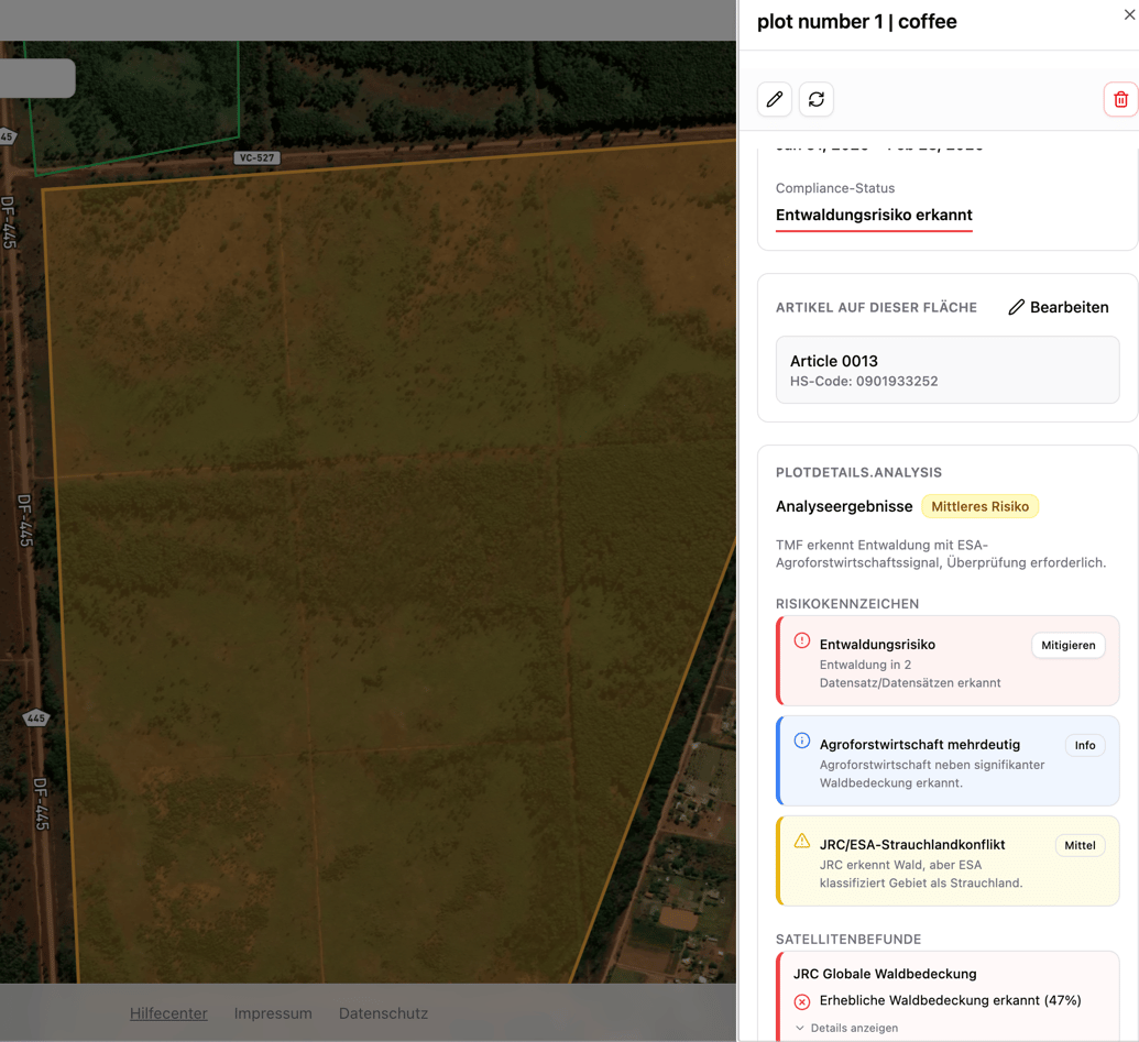
Area details with risk indicators and satellite analysis
Area Status After Analysis
Skipping the analysis for low-risk countries is optional and enabled under Settings → Automations.
Legal Risk Assessment
In addition to the geographic analysis, the system checks legal compliance based on the questionnaire and the submitted documents. Risks are identified per risk category of the respective production country.Legal Risk Categories
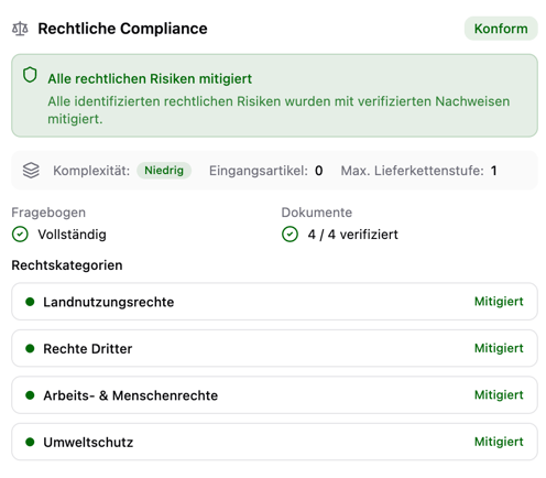
Legal risk categories with status
Compliance Dashboard
Once the analysis is complete, the compliance dashboard (inbound) shows a complete overview: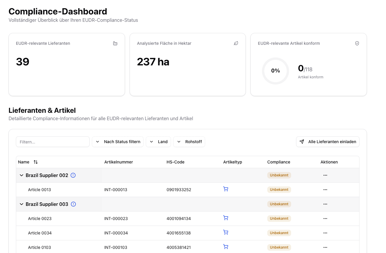
Compliance dashboard with overview metrics
- EUDR-relevant suppliers — number of affected suppliers
- Analyzed area — total area in hectares
- Compliant articles — number of compliant EUDR-relevant articles
- Pending actions — articles with missing geodata, missing legal analysis, or a missing report
Compliance Status per Article
In the compliance dashboard (inbound), you see the overall status for each article: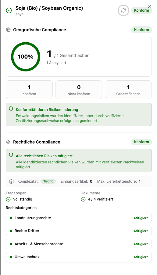
Compliance details for an article
- All production areas pass the geographic analysis (or risks are mitigated)
- All legal compliance categories are fulfilled
- The entire supply chain has been assessed
Next Steps
If risks have been detected, they must be mitigated before a DDS can be created:Risk Mitigation
Mitigate detected risks with the mitigation dialog.
Reports
Generate and download compliance reports.